|
||

|

|
|

|
An early and captivating bird's-eye view pamphlet map, circa 1915, showcasing the picturesque landscape of San Bernardino and its surrounding areas, printed by The Sun and the Union Label Typographical Company of San Bernardino, with the view artistry of R.E. Mitchell from Los Angeles.
This folding bird's-eye view map provides a fascinating perspective of San Bernardino City and Valley, capturing the charm of the region during the early 20th century. The map illustrates the city's remoteness, surrounded by farmland and distant from neighboring Upland and Ontario. Redlands is depicted as a small town in the lower-right corner, while the scenic Big Bear Lake is visible in the upper-right.
The map highlights the Mountain Crest Highway, the famous "101 Miles on the Rim of the World," showcasing the awe-inspiring route along the mountain ridge. This captivating piece of cartography, rendered by R.E. Mitchell, offers a unique glimpse into the history and geography of San Bernardino City and Valley, as well as the neighboring areas.
In conclusion, this bird's-eye view map of San Bernardino City and Valley, along with the Mountain Crest Highway, provides a captivating look at the region during the early 20th century. The map highlights both the natural beauty and the agricultural landscape, offering valuable insight into the history and development of San Bernardino and its surrounding areas.
Rare.
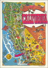
![[Southern California Views] Delightful Southern California, The Land of Sunshine and Bloom](https://storage.googleapis.com/raremaps/img/small/74862.jpg)