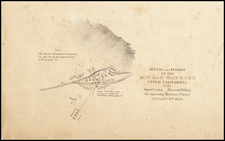
|
||

|

|
|

|
A rare and intriguing 1940 folding pictorial trail map of Giant Forest Sequoia National Park, designed to encourage visitors to leave their automobiles and explore the park on foot, while celebrating the 50th anniversary of the park's establishment (1890-1940).
This map, which comes with a message from E.T. Scoyen, Superintendent of the United States Department of Interior National Park Service, presents an extensive network of safe and easy trails throughout the Giant Forest. The map emphasizes that the park is home to 3,000 trees with a diameter of more than 10 feet, inviting visitors to experience the majesty of the world's greatest forest up close.
The map marks the location of the General Sherman tree, dubbed the "Biggest Tree in the World," as well as other notable landmarks such as Camp Kaweah Village and Giant Forest Lodge. Numerous trees are also depicted and labeled, providing visitors with a comprehensive guide to exploring the park's natural wonders.
As a historical artifact, this trail map offers valuable insight into the early management and promotion of Sequoia National Park, as well as the evolving attitudes towards nature conservation and outdoor recreation during the 20th century. This captivating pictorial map is a must-have for collectors and enthusiasts interested in the history of national parks, cartography, and environmental conservation.
![California Water and Mining Co. [with:] Map of El Dorado County, Cal. Showing the Georgetown Divide and Portions of the Placerville and Forrest Hill Divide with the Ditches, Mines and Other Properties of the California Water Co. Situated Between The South Fork of Middle Fork and the South Fork of the American River 1880](https://storage.googleapis.com/raremaps/img/small/91927.jpg)