|
||

|

|
|

|
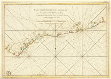
The 1960 reprint of the Niger Fifth Edition Sheet 14, drawn and reproduced by the Survey Department in Lagos, Nigeria in 1953 and later reprinted by Federal Surveys, Nigeria, stands as an essential cartographic record reflecting Nigeria's geographical and political landscape shortly after the country achieved independence.
This map's focal point is the River States, located on the southeastern coast of Nigeria, an area that encapsulates significant river systems such as the Niger River Delta on the west side and the entrance to the Cross River on the east side. These waterways, historically critical to Nigeria's commercial and cultural growth, are accurately portrayed in this edition.
Updated to show boundaries as of January 1960, the map not only illustrates the physical features of the time but also mirrors the dynamic political climate. Having been printed in December 1960, it stands as a symbol of Nigeria's transition from a British colony to an independent nation, capturing this significant shift in its representation of the country's internal and external boundaries.
The map's detailed representation at a scale of 1:500,000 evidences the meticulous work of the Nigerian survey departments during this transformative period. By documenting the precise layout of the River States region's waterways and landscapes, it offers a clear snapshot of the nation's geographical disposition at the dawn of its independence.
The Niger Fifth Edition Sheet 14 thus serves as a valuable cartographic timepiece. It captures a pivotal moment in Nigeria's history, reflecting the complex interplay between the nation's geographical features and its evolving political landscape at the time of its independence.