|
||

|

|
|

|
The Most Comprehensive Early Texas Oil Map That We Have Encountered.
Lithographed folding map of printed in black and yellow, and overprinted in red, showing oil and gas fields, pipelines, and refineries.
The map would appear to date from before the major exploitation of the East Texas Oil Field, which was attempted as early as 1911, but did not achieve real success until 1930.
The map provides an overview of the massive expansion that took place in the Texas oil industry starting with the discovery at Spindletop. It illustrates the early regions of discovery around Galveston Bay and to the Sabine, as well as the discoveries at Wichita Falls and Eastland, and the gas fields of southern Oklahoma.
Perhaps one of the most important aspects of the map is its coverage of oil infrastructure; many pipelines are named and delineated, and refineries, particularly on the Gulf are noted -- and the numbers of refineries in the given areas are printed as well (e.g., "1" at Texas City.)
The publication relationship between Gallup and West is unclear in this map. The base Gallup map does not seem concerned with oil (there's no mention of it in the title, though there is a gusher illustrated in the lower left), whereas the M.H. West covers make it clear that their business was the "Latest Oil Maps | On Cloth or Paper -- Delivered to Your Office". It is likely that the map was either commissioned to be modified by M. H. West, or that they did the overprinting themselves. Such measures were necessary to keep up with everchanging demand during the first decades of the Texas oil boom.
Variant
This example advertises Southwest Securities Company of Kansas City, Missouri. The previous example we handled did not have this advertisement.

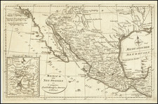
![Nouvelle Carte Du Mexique, Du Texas Et D'Une Partie Des Etats Limitrophes . . . 1840 [Proposed Railroads In Texas -- First Appearance of Arizona on a Printed Map]](https://storage.googleapis.com/raremaps/img/small/103480.jpg)
![(JFK Assassination) Dallas Murder Map, Dealey Plaza, Dallas Texas [with:] [Entry Wound Diagram - Dallas, Nov. 22, 1963]](https://storage.googleapis.com/raremaps/img/small/97080.jpg)
![La Parte Occidentale Dell'Antico, E Nuovo Messico Con Florida E La Bassa Luigiana…. 1798 [California & The Southwest!]](https://storage.googleapis.com/raremaps/img/small/95816.jpg)