


|
||

|

|
|

|
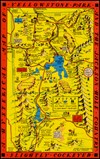
Mapping The Lander Wagon Road
Fascinating map of the area north and northwest of the Great Salt Lake, created as a result of government surveys undertaken as part of the search for a suitable route for the Transcontinental Railroad, compiling the work of several prominent governments explorers, including Frederick W. Lander, J.F. Mullowney, J.H. Ingle, B.F. Ficklin, and W.H. Wagner.
Frederick W. Lander was commissioned by the US government in 1857 to explore potential wagon roads through the Rocky Mountains. The United States government employed him on transcontinental surveys to select a route for a Pacific railroad. Later he undertook a survey for the same purpose at his own expense and was the only man of the party to survive. He constructed an overland wagon route in the face of great difficulties and constant hostility of the Indians. After its completion in 1859, the Lander Road became popular with wagon trains as an alternate route from Burnt Ranch in the Wyoming Territory to Fort Hall in the Oregon Territory.
The map shows the proposed route for the wagon road, highlighting geographic features such as mountains, rivers, and valleys. It also shows notable landmarks and forts, along with topographical information about the terrain, elevations, and distances between different points along the route.
The map also notes the contributions of John F. Mullowney, J.H. Ingle, Benjamin Franklin Ficklin, and W.H. Wagner.
![[Montana, Wyoming, Dakota, Upper Missouri River] Amer. Sep. No. 40. Partie des Etats Unis](https://storage.googleapis.com/raremaps/img/small/93546.jpg)
![[ Idaho Below Montana ] Verein-Staaten am Stillen Ocean… [inset of San Francisco Bay] [Unusual Idaho & California configurations]](https://storage.googleapis.com/raremaps/img/small/99297.jpg)
![California [with large inset of Utah and Part of New Mexico]](https://storage.googleapis.com/raremaps/img/small/92004.jpg)
![Northeastern Arizona / Southern Utah / Northwestern New Mexico] Hopi Reservation / Navajo Reservation]](https://storage.googleapis.com/raremaps/img/small/72197dd.jpg)