


|
||

|

|
|

|
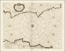
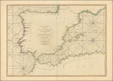
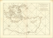
Magnificent sea chart of the western Mediterranean, from Otten's Orbis Maritimus ofte Zee Atlas.
Extending from the the Adriatic Sea to the Straits of Gibraltar, this is a sea chart, constructed in the Portolan chart tradition, showing exclusively coastal details. Two ornate cartouches and multiple sailing ships, compass roses and rhumb lines.
The Ottens brothers, Reiner and Joshua, operated a successful printing partnership in the mid-eighteenth century (fl. 1726-1765). They began the venture in 1726, publishing maps and other prints as “R & I Ottens.” They specialized in the reprinting of others’ work, especially Guillaume De L’Isle. In 1750, Reiner died; his soon, also Reiner, took his place, but the firm began listing their works as “Joshua & Reiner Ottens.” The firm lasted until Joshua’s death in 1765. Joshua’s widow, Johanna de Lindt, sold their remaining stock of plates in 1784.
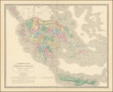
![Carte de la Turquie, de l'Arabie et de la Perse, dressée sur les mémoires les plus récents rectifiée par les observations de Messieurs de l'Académie Royale des Sciences par G. de L'Isle, géographe. [Map of Turkey, Arabia, and Persia, drawn up based on the most recent memoirs and corrected by the observations of the gentlemen of the Royal Academy of Sciences by G. de L'Isle, geographer.]](https://storage.googleapis.com/raremaps/img/small/94075.jpg)
![Le Vere Imagini et Descritioni delle Piu Nobilli Citta del Mondo [The true images and descriptions of the most noble cities in the world]](https://storage.googleapis.com/raremaps/img/small/92842.jpg)