|
||

|

|
|

|
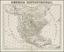
The English Empire in America, a miniature engraved map first issued as a playing card by John Seller in London in 1676 (this edition issued circa 1679), provides a fascinating perspective on the territorial understanding and imperial aspirations of the English in North America.
The late 17th century saw the emergence of England as a significant colonizing power in North America, contesting French and Spanish claims. This map encapsulates this contestation by demarcating New France strictly to the St. Lawrence River basin, thereby illustrating the French's actual control rather than their larger territorial claims. This decision may reflect England's challenge to France's imperial ambitions in the region.
The map's representation of California as an island, a cartographic misconception widely circulated in the 17th and 18th centuries, embodies the geographical uncertainties of the era. The double-bay format for California, first used by Luke Foxe in 1635, further attests to the influence of earlier exploratory expeditions on the cartographic imagination of the period.
This state lacks the portrait of Queen Mary (which Queen Mary is a matter of debate, as there was no Queen Mary until James II ascended to the throne in 1685, and we know the plate was modified to remove the portrait years before that happened. Burden opines that it relates to Henrietta Maria, the mother of Charles II.)
In sum, John Seller's "The English Empire in America" stands as a testament to the burgeoning English imperial ambitions and their evolving geographic understanding of North America in the late 17th century. The map's distinctive features, its related mysteries, and its historical context make it a captivating piece of early colonial cartography.
Rarity
We trace no copies on the market (in OldMaps.com) since 2004.
John Seller was one of the most notable map and instrument makers in England in the late-seventeenth century. He was especially known for the sea charts, many of which featured in his influential English Pilot and Atlas Maritimus. Seller was born in London in 1632. His father was a cordwainer and John was apprenticed to Edward Lowe, of the Merchant Taylors’ Company. He was made free of that company in 1654. Later, he also was made a brother of the Clockmakers’ Company, which housed several instrument makers. He started business as a compass maker but expanded his offering to include navigational instruments and charts.
Seller’s career was halted temporarily, and fantastically, when he was tried for high treason in 1662. He was accused of involvement in a plot led by Thomas Tonge. While Seller likely only unwisely repeated rumors, he was convicted. The other conspirators, who did admit some degree of guilt, were executed, but Seller maintained his innocence and, via insistent petitions, he eventually secured his release from Newgate Prison.
This episode did not seem to slow Seller’s rise too much, however. Seller was granted a royal license to publish English-language maritime atlases. This gave him a near-monopoly and led to his being named hydrographer to the King in 1671. Although the point of the project was to produce English charts of Dutch dominance and bias, Seller ended up using many Dutch plates as his base material. The first volume of The English Pilot was published in 1671, followed by more volumes as well as The Coating Pilot (1672) and the Atlas Maritimus (1675). Seller was commercially successful, but some of his projects required further support. The English Pilot was eventually taken over by John Thornton and William Fisher, for example, and his proposed English atlas only produced maps of six counties.
Seller’s sons, John and Jeremiah, followed in their father’s profession. Seller also apprenticed several promising young men, including Charles Price, with whom his sons partnered. Through Price, Seller can be seen as the founding figure of an important group of London mapmakers that included Price, John Senex, Emanuel Bowen, Thomas Kitchin, and Thomas Jefferys.
![[Unusual Italian Immigrant Communities shown!] America Settentrionale, Centrale e Meridionale -- Carta Dimostrativa Delle Ambasciate, Legazioni, Consolati (Con Le Risettive Circoscrizioni Territoriali), Camere Di Commercio, Agenzie Commerciali, Stazion Enotecniche, Uffici Postali, Ospedali, Scuole Governative e Sussidiate All'Estero](https://storage.googleapis.com/raremaps/img/small/86098.jpg)
![[An English Propaganda Map In French] Carte Des Possessions Angloises & Francoises Du Continent De L'Amerique Septentrionale 1755.](https://storage.googleapis.com/raremaps/img/small/86975.jpg)