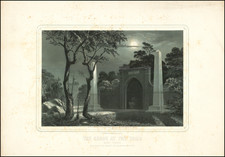
All of our maps are authentic antique maps, printed or drawn on or about the date shown in the description. In rare instances when we offer facsimiles, we will specifically describe the map as a later facsimile and include the date of publication. Certificates of Authenticity are included with each item.
Map Maker
Fast, Global Shipping
Last year we shipped over 4,500 antique maps to more than 50 countries. Maps are shipped Monday through Friday year-round. If an order is received before 2 PM PST, we will ship the order that day. If an order is received after that time, we will ship the next day. We ship maps either flat in custom packages or in specially ordered thick tubes. Shipping rates are provided as part of the checkout process.
Description
Scarce early map of Virginia and Maryland, showing counties, rivers, towns, mountains, lakes, etc. Includes early roads.
This is one of the earliest British publications to show the US by states.


![[ Washington DC / Virginia / Maryland / Delaware / New Jersey ] Washington Sectional Aeronautical Chart](https://storage.googleapis.com/raremaps/img/small/99620.jpg)
![[ Pictish Warrior Woman ] Feminae Pictae icon V](https://storage.googleapis.com/raremaps/img/small/99648.jpg)
![The Shortest Direct Route to Norfolk and Virginia Seashore by Chesapeake Ferry Co. [Direct Ferry Routes North & South Across Historic Hampton Roads]](https://storage.googleapis.com/raremaps/img/small/91597.jpg)