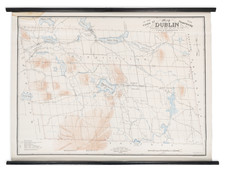


|
||

|

|
|

|
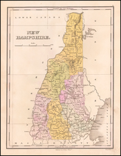
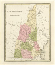
Interesting and detailed map of New Hampshire, from the first edition of Bradford's Illustrated Atlas.
The map is colored by counties and shows towns, rivers, lakes,and other important places.
In the 1830s, New Hampshire was a largely rural state with a growing population. The economy was based primarily on agriculture and manufacturing, with many small farms and textile mills scattered throughout the state. The state's transportation infrastructure was limited, with most goods being transported by horse-drawn wagons or boats on the state's many rivers.
Thomas Gamaliel Bradford (1802-1887) was an American geographic publisher. He hailed from Bradford, Massachusetts and began his publishing career by working for the America Encyclopedia. Then, he edited and republished the Atlas Designed to Illustrate the Abridgement of Universal Geography, Modern & Ancient, which had originally been offered in French by Adrian Balbi. In 1835, he published another atlas, A Comprehensive Atlas: Geographical, Historical & Commercial, and, in 1838, An Illustrated Atlas Geographical, Statistical and Historical of the United States and Adjacent Countries. His interests were primarily in educational publishing and he was one of the first mapmakers to show Texas as an independent country.