|
||

|

|
|

|
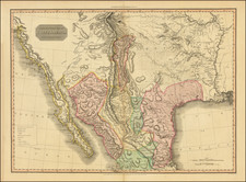
Rare Map of the Valley of Mexico Showing the Now Vanished Lake System
Finely detailed plan of the lake system of the Valley of Mexico, engraved by Tomas Lopez.
The area mapped is from Tula (NW) to Pachuca (NE), Amecameca (SE) and Atlapulco (SW). Details included are old and new works of drainage (the desagüe) and principal roads. In addition, there are mountains and volcanoes, dormant and active, shown in semi-perspective. The compass indicator is in Lake Texcoco itself, showing the map to oriented with east at the top.
The map was first engraved for Solis' classic work on the conquest of Mexico by Hernán Cortés; its author, the greatest chronicler of the Indies and playwright Antonio de Solís, had access to archival sources.
Draining the Lake
As indicated by this map, the Lago de Mexico, also known as the Lago de Texcoco (here called Laguna de Tescuco), was one part of a large lake system that used to be in central Mexico. Agriculture near the lake began 7,000 years ago with several early civilizations competing to control access and farming near its shores.
After the fall of Teotihuacan in 600-800 AD, several other city states fought for prominence in the region. In 1325 the Aztecs founded Tenochtitlan on the western side of the lake, developing their capital city on an island via a system of dams and canals. This city became the Federal District. There were large floating gardens, chinampas, on the lakes; they surrounded the capital city and were also prevalent in other shore areas.
After the Spanish took Tenochtitlan, they never repaired the Aztec dams, making flooding a recurring problem in the region. To stem the floods, the Spanish attempted to drain the lake, with a major effort to divert water and improve drainage as part of the Bourbon reforms in the eighteenth century. This was called the Desag üe del Valle de México. However, drainage was not entirely successful until the mid-twentieth century. Now, the majority of the lake system is dry, with a considerable portion of the lake valley now serving as an urban area.
Tomás López de Vargas Machuca (1730-1802) was one of Spain’s most prominent cartographers in the eighteenth century. He was born in Toledo but studied at the Colegio Imperial in Madrid, where he focused on mathematics, grammar, and rhetoric. Along with a small group of colleagues, in 1752 the Spanish government sent López for training in Paris with the renowned geographer Jean Baptiste Bourguignon d’Anville. When he returned to Spain he was named Geógrafo de los dominios de Su Magestad and put in charge of the geographic collections of Charles III. He published many maps, including his fascinating maps of the Americas, and a variety of geography manuals. Some of his most famous maps are of the Iberian Peninsula, part of his large project to create a majestic atlas of Spain. Unfinished in his lifetime, López's children published the Atlas Geográfico de España (Geographical Atlas of Spain) in 1804. It was republished in 1810 and 1830.