|
||

|

|
|

|
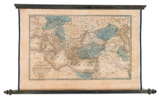
A fantastic rare "popular print" 18th-century three-sheet wall map that depicts the Holy Land and the city of Jerusalem. It was published by George Thompson on November 18, 1795.
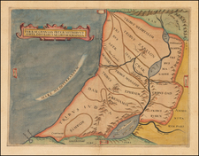
The original prototype for this map seems to have been van Doetechum's 1641 Niewe Caertees das Lants von Beloften ende (Nebenzahl, Holy Land, pp. 120-124). English versions of which were issued by Overton (ca. 1717), Sayer (ca. 1752), Cluer Dicey (ca. 1765), G. Thompson (1795), and others throughout the 18th century. An American edition was published by Thomas Duffield's map in Philadelphia in 1828.
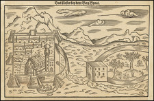
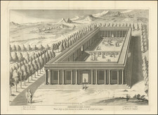
The map is richly detailed and includes many illustrations of scenes from the bible scattered throughout the image. In the lower-left corner, there is a view of Jerusalem titled "A Prospect of Jerusalem." The map is also covered with engraved annotations that provide additional information about the various locations depicted on the map.
George Thompson was a publisher of popular prints in the late 18th and early 19th centuries. He often worked in collaboration with John Evans, also of Long Lane. Thompson was known for producing bold etchings, a type of print that became popular in the 1790s. According to the British Book Trade Index, he was registered as a copperplate printer at 50 Old Bailey until around 1796. From then until his death in 1826, he operated his business at 43 Long Lane. After Thompson's death, his son, also named George Thompson, continued the business until 1839. Both father and son published prints under the Thompson name.
The imprint line on this print indicates that Thompson was publishing at 43 Long Lane in late 1795.
![[ Tribes of Zabulun Issachar, Manasseh ] Tribus Zabulon, Isachar, et, Dimidia Manasse altera, hoc est illae Terrae Sanctae regiones . . .](https://storage.googleapis.com/raremaps/img/small/95602.jpg)