This item has been sold, but you can enter your email address to be notified if another example becomes available.


|
||

|

|
|

|
Stock# 90720
Description
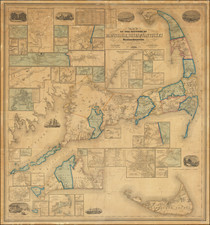
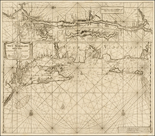
Detailed chart of the approaches the the region around Cape Cod, Martha's Vineyard and Nantucket Island, along with Boston Harbor to the North, published by the US Coast & Geodetic Survey.
The map locates numerous light houses, buoys, and other navigational aids, and is filled with soundings and sailing directions, tidal charts and other details. At the bottom are 4 coastal profile views.
Includes evidence of contemporary use.
Condition Description
Blue backed chart. Light soiling.