
This item has been sold, but you can enter your email address to be notified if another example becomes available.


|
||

|

|
|

|
Stock# 90716
Description
Unrecorded E. & G.W. Blunt Map of the English Channel.
Huge, American-published blueback navigational chart of the English Channel, printed in 1846.
The map shows the Channel in magnificent and extremely fine detail. The map stretches from the southern portion of Ireland through to Wales, the south coast of England, northern France, and the Low Countries. Thousands of soundings are shown throughout. Sandbanks, coastal defenses, harbors, and more are all indicated. Lighthouses are highlighted.
The Blunt firm was one of the earliest firms to publish sea charts in the United States. The company started maps in New York in the late 1810s.
Rarity
We are unable to locate any other examples of the map through OCLC, RBH, or any other sources.
Condition Description
Scattered dampstaining, particularly to the right and some foxing.
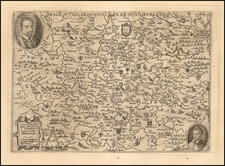
![[ Northern England ] Die Koenigreichs England nordlicher Theil oder York Shire, das Bisthum Durham, Northumberland, Cumberland, Westmoreland und Lancashire . . .](https://storage.googleapis.com/raremaps/img/small/103743.jpg)
![[Battle of Chatham / Raid on the Medway] Afbeeldingh van de stadt en revier van Rochester, Chatham . . . 1667 | Het Eylandt Shepey en 't Fort Shirenasse verovert ende geplondert op den 20 en 21 Junij 1667](https://storage.googleapis.com/raremaps/img/small/86137.jpg)
![[ Julius Caesar's Gaul ] Gallia vetus ex C. Julii Caesaris commentariis descripta, ex conatibus... 1649](https://storage.googleapis.com/raremaps/img/small/102569.jpg)