


|
||

|

|
|

|
Stock# 90279
Description
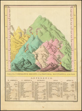
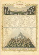
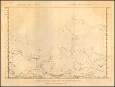
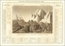
Interesting Russian-language version of the Mountains & Rivers plates found in many 19th-century atlases.
The map shows the comparative sizes of the world's larger lakes and rivers.
This version includes the depths of lakes and the elevation traversed by the rivers from their headwaters to their mouths.
An interesting, different version of this popular decorative type of data visualization.
Condition Description
Some minor toning and foxing.
![Comparative Size of Lakes and Islands [Great Lakes, Cuba, Formosa, Ireland, Sicily, Cyprus, Vancouver, Sandwich Islands, Puerto Rico, Corsica, Sardinia, Balearics, Malta, etc]](https://storage.googleapis.com/raremaps/img/small/92574.jpg)
![Comparative Size of Lakes and Islands [Great Lakes, Cuba, Formosa, Ireland, Sicily, Cyprus, Vancouver, Sandwich Islands, Puerto Rico, Corsica, Sardinia, Balearics, Malta, etc]](https://storage.googleapis.com/raremaps/img/small/100135.jpg)