


|
||

|

|
|

|
Flooding in the Budapest Ghetto After Liberation.
Hand-annotated map of the area surrounding the Budapest ghetto, published in August of 1945.
The map shows the area that includes the Budapest Ghetto as well as the area immediately to its north. While the original Jewish quarter (now known as the "Party District" encompassed significantly more of the area shown on the map, by the end of the Second World War the Ghetto was limited to a .1 square mile area roughly bounded by Erzsebet Krt., Kiraly u., Somogyi Bela ut, and Rakoczi ut, which housed some 76,000 Jewish people.
The legend appears to suggest that the buildings to the south of Klauzal Ter shaded in blue were subject to the risk of flooding, while those with a k had already flooded. Flooding in Jewish ghettos was nothing new - Jewish quarters had historically been built in the areas of the city most prone to flooding, including the Venetian Jewish ghetto, the Roman Jewish Quarter, and the Parisian "Marais" (literally, "Marsh").
The Budapest ghetto was created in November of 1944 and lasted for less than two months prior to the liberation of Budapest by the Soviets. However, during that time, the ghetto was completely sealed off from the outside world, with an encircling wall. The initial population of 70,000 Jews in the ghetto was reduced to 20,000 in those two months.
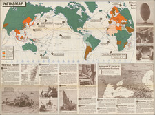
![(World War II) [Iwo Jima Aerial Reconnaissance Photograph, March 8, 1945]](https://storage.googleapis.com/raremaps/img/small/83776.jpg)
![Carte de la Hongrie et des Pays qui en dependoient autresois dressée sur un grand nombre de memoire. . . 1703 [Map of Hungary and the countries that used to depend on it, previously drawn from a large number of records... 1703.]](https://storage.googleapis.com/raremaps/img/small/93871.jpg)
![[Western Hungary] Des Konigreichs Ungarn westlicher Theil Nro. 29.](https://storage.googleapis.com/raremaps/img/small/89312.jpg)