|
||

|

|
|

|
Including "My Wife's Island" on the Mississippi River
Rare set of maps of Louisiana and Mississippi, published by the British House of Commons for the Third Report from the Select Committee on Emigration from the United Kingdom: 1827.
Detailed group of 5 maps illustrating sections of the Mississippi River in Louisiana, generally in the area of Vicksburg, Mississippi, published by the British Government, as a means of illustrating the availability of cheap land in the United States, and specifically north of the Red River in Louisiana.
The maps were part of a rare Parliamentary report, which examined the great numbers of citizens emigrating from England, Ireland and Scotland. The select committee investigation compiled data and ultimately recommended that emigration should not be funded by the British Government. The primary focus of the committee's interest addressed the issue of whether Irish landlords could assist by clearing estates and giving free passages to their dispossessed tenants. Most of the Report consists of hearings and transcripts of testimony, however the inclusion of this group of maps is noteworthy The report noted that emigration was focused on the United States, in this case Louisiana near the confluence of the Red and Mississippi Rivers. In the report, the maps are preceded by a copy of the U.S. Federal Government Act making available for purchase lands at no less than $1.25 per acre to anyone.
The maps are credit Charles Gordon, but later typically credit others for the actual survey work, including:
- G. Davis, Surveyor of Public Lands (United States) South of the State of Tennessee
- Levon Wailes, Surveyor of Public Lands in the states of Louisiana & Mississippi.
- Maxfield Ludlow, Deputy Surveyor
- John B. Peyton, Deputy Surveyor
- Ephraim Ludlow, Deputy Surveyor
Each measures approximately 16" x 14" and uses hand coloring to indicate sold lands. 1) Township 17, N. Range 14 East. Land District north of Red River in the State of Louisiana; 2) T.11 N. R. VIII. E. District North of Red River Louisiana.; 3) Township 15, N. Range 1 East. Land District north of Red River, State of Louisiana; 4) Township 20 N. Range 13 East, Land District North of Red River in the State of Louisiana; and 5) A Map, exhibiting the order of the Survey of the Public Land of the United States of North America. By Charles Gordon, Draughtsman. 1825. This is the general map of the area.
![[ Vicksburg Battle Plan ] Map Illustrating The Operations of the U.S. Forces Against Vicksburg.](https://storage.googleapis.com/raremaps/img/small/60302.jpg)
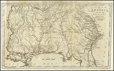
![[ Extensively Annotated By An Early Owner ] Georgia from the latest Authorities](https://storage.googleapis.com/raremaps/img/small/100877.jpg)