|
||

|

|
|

|
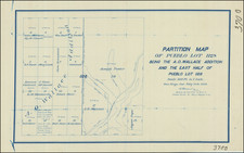
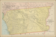
Scarce locally-produced map of San Diego County (with focused maps on the verso) prepared at the time of the Panama-California Exposition in Balboa Park.
The map was produced by perhaps the most important San Diego mapmaker, Rodney Stokes, fairly early in his career. Stokes was making maps before 1910, but most of his maps were made after 1920.
A pastedown in the covers notes places of interest in San Diego county and how to get there: "LA JOLLA - Trains leave hourly during the day from ticket office at 1032 Fourth Street... There are also good automobile roads to all of these places. See county road map."
The map notes "1915" in Balboa Park, which is likely a prospective indication that the Exposition would happen there in the following year.
![(San Diego) [Downtown San Diego Embarcadero and Seaport Village area south of Market Street]](https://storage.googleapis.com/raremaps/img/small/96681.jpg)