|
||

|

|
|

|
Detailed map of northern Romania, near the Ukrainian border, extensively annotated in a contemporary hand showing military movements.
Guru Humorului, traditionally home to a large Jewish population, was the scene of extensive fighting between July and September 1944, as Soviet troops pushed the axis front westwards. This map shows troop movements, positions, defensive lines, and other military features in and around the town, extending towards neighboring villages, including Suceava and Fălticeni.
The map names regiments and battlefield commanders, including "Neuhoff," Theodoresu," and "Nicololui." Division and regiment annotations are also shown.
Gura Humorului contained almost 3000 Jews at the outbreak of World War II and possessed a Jewish social and political institute. Nearly all were deported in 1941, and the region was finally liberated by the Soviets in the fall of 1944.
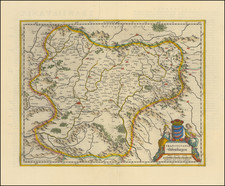
![Von den Sieben burgen [Siebenberg / Transylvania]](https://storage.googleapis.com/raremaps/img/small/78330.jpg)
![(Second World War - Eastern Front) [The Soviet Encirclement of Konigsberg]](https://storage.googleapis.com/raremaps/img/small/65659.jpg)