|
||

|

|
|

|
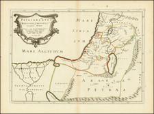
Striking example of Mercator's Ptolemaic map of the Middle East.
The Asiae VI Tab. by Gerard Mercator is a fascinating testament to the enduring influence of Claudius Ptolemy's geographical concepts, offering a detailed representation of regions such as Arabia, the Red Sea, and the Persian Gulf. This map, hailing from the 1595 edition of Mercator's Geographia, resonates with a profound sense of reverence for Ptolemaic principles.
Gerard Mercator, born in 1512 in Flanders, Belgium, is best known for his influential Mercator projection and the innovative use of the term "Atlas" for a collection of maps. However, beyond these groundbreaking contributions, Mercator harbored a deep fascination for Ptolemaic cartography.
Claudius Ptolemy, a Greco-Roman scholar of the 2nd century, significantly impacted Mercator's life and work. His book, Geographia, was a trove of geographic knowledge, describing the world with the Mediterranean at its center. Ptolemy's work, while subject to inaccuracies due to limited explorations of the time, introduced longitude and latitude and had a profound impact on mapmaking in the 15th and 16th Centuries.
Mercator was captivated by Ptolemy's vision of the world and made it his lifelong project to refine and enhance Ptolemaic maps based on evolving geographical knowledge. His intent was not to contradict or challenge Ptolemy, but to build upon the foundations that the Greek scholar had laid.
The Asiae VI Tab. is a prime example of Mercator's Ptolemaic quest. The map portrays Arabia, the Red Sea, and the Persian Gulf, integrating Ptolemy's geographical outlines with Mercator's corrections based on more contemporary data. The map’s exquisite details and precise renderings hint at Mercator’s dedication to the craft and his respect for Ptolemaic principles.
Though Mercator's fame primarily rests on his original cartographic innovations, his works like Asiae VI Tab. reveal a different facet of his intellectual journey. They showcase his commitment to marrying the past's wisdom with the present's knowledge, thus bridging the gap between ancient and modern geography.
Gerard Mercator is one of the most famous cartographers of all time. Mercator was born in Flanders and educated at the Catholic University in Leuven. After his graduation in 1532, Mercator worked with Gemma Frisius, a prominent mathematician, and Gaspar a Myrica, a goldsmith and engraver. Together, these men produced globes and scientific instruments, allowing Mercator to hone his skills.
With his wife, Barbara, Mercator had six children: Arnold, Emerentia, Dorothes, Bartholomeus, Rumold, and Catharina. In 1552, Mercator moved to Duisburg from Leuven, where he lived for the rest of his life. In 1564, he was appointed the official cosmographer to the court of Duke Wilhelm of Cleve.
Mercator’s most important contribution was the creation and popularization of a projection which now bears his name. On Mercator projection maps, all parallels and meridians are drawn at right angles to each other, with the distance between the parallels extending towards the poles. This allowed for accurate latitude and longitude calculation and also allowed navigational routes to be drawn using straight lines, a huge advantage for sailors as this allowed them to plot courses without constant recourse to adjusting compass readings.
Mercator’s other enduring contribution to cartography is the term “atlas”, which was first used to describe his collection of maps gathered in one volume. The Mercator atlas was published in 1595, a year after Mercator’s death, thanks to the work of his sons, particularly Rumold, and his grandsons.
![[Arabian Peninsula] Sexta Asie Tabula [Arabia Felix.]](https://storage.googleapis.com/raremaps/img/small/84313.jpg)
![(First state!) [Arabia and Persian Gulf] Tabula Asiae VI](https://storage.googleapis.com/raremaps/img/small/94608.jpg)
![Carte Particuliere d'une Partie d'Asie ou sont Les Isles D'Andemaon, Ceylan, Les Maldives . . . [with] Partie Occidentale d'une D'Asie ou sont les Isles De Zocotora De l'Amirante . . .](https://storage.googleapis.com/raremaps/img/small/99858.jpg)