|
||

|

|
|

|
Giacomo Gastaldi's First Published Map
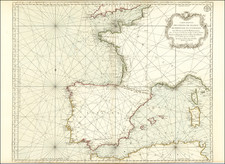
An excellent example of Giacomo Gastaldi's highly significant first separate map production, the finest 16th-century map of Spain, published in Venice in 1544.
The map covers all of the Iberian Peninsula and the Pyrenees. The whole of the Peninsula is referred to as "La Spaña", which invites notions of the Iberian Union, though that would not formally occur until 1580, 36 years later. The cartography for the map was supplied to Gastaldi by Don Diego Hurtado de Mendoza, Spanish ambassador to Venice (1539-47) on behalf of Charles V. Bifolco & Ronca suggest that Don Diego was introduced to Gastaldi through Giovanni Battista Ramusio, though Gastaldi had his own important connections to the Venetian Senate.
Gastaldi first appears in the historical record in 1539, when he was granted a privilege to print a perpetual calendar by the Venetian Senate. The present map, dated 1544, is frequently considered to be Gastaldi's first printed map, although some scholars believe that the map of Germany from the 1548 Gastaldi La Geografia di Claudio Ptolemeo Alessandrino . . . may have been completed as early as 1542, as it bears that date. However, it was not published until 1548 along with the rest of the atlas. According to Karrow, Gastaldi's early interactions with Ramusio, including his participation in the latter's Navigationi et Viaggi (first volume first published in 1550), helped to convince the former to pursue cartography as a full-time career.
Bifolco & Ronca (2018) tav. 456:
Giacomo Gastaldi's map of Spain constitutes the best cartographic rendering of the region from the 16th century. . . . the map of the Iberian Peninsula represents Gastaldi's first cartographic work. In the dedication Gastaldi signs the map and introduces himself, Giacomo Castaldo Piemontese de Villa franca, cosmographo. Alli Spettatori. Salute. Furthermore, he adds that the sources of the work are the information provided to him by Don Diego Hurtado de Mendoza, Spanish ambassador to Venice (1539-47) on behalf of Charles V, who was probably introduced to him by Giovan Battista Ramusio. There are no known reprints.
Gastaldi's map is a grand landmark for the mapping of Iberian Peninsula, far superior to any map before. Gastaldi's map would exert an enormous influence on the subsequent peninsular cartography, providing a remarkable compilation of toponyms, in which Castilian names are combined with others of Latin and Catalan roots. Its careful composition includes the indication of climates and parallels with the duration of the days noted along with the graduated margins.
Rarity
The map is very rare with no examples appearing on the market for over 20 years.
We note a single example at auction (Sotheby's 2000) and a single auction in a dealer catalog (Nebenzahl, 1983 -- likely this example).
Giacomo Gastaldi (1500-1566) is considered the foremost Italian cartographer of the sixteenth century, alongside Paolo Forlani. His skills of compilation are comparable to those of Mercator and Ortelius, yet much less is known of his life than of his two contemporaries. Gastaldi was born in Villafranca, Piedmont, but had established himself in Venice by 1539. He originally worked as an engineer, but turned to mapmaking from the 1540s onward.
It was in Venice where he made his reputation as an engraver, geographer, and cosmographer; for example, he was asked to fresco maps of Asia and Africa in the Palace of the Doge, or the Council of Ten, Venice’s governmental body. He also frequently consulted on projects for the Savi sopra la Laguna, drawing maps for this body which oversaw the regulation of fresh and salt water around Venice.
His contemporaries also recognized his skill, as he was named cosmographer to the Republic of Venice, was a member of the Accademia Veneziana, and was a major source for other geographers and mapmakers including Camocio, Bertelli, Cock, Luchini, and Ortelius. He even had his own distinct style of copper engraving that made him a pioneer in his day and makes his works iconic today.
Gastaldi enjoyed an especially productive relationship with Giovanni Battista Ramusio, Secretary of the Venetian Senate, who used Gastaldi's maps for his famous travel account collection, Navigationi et Viaggi. Gastaldi also tutored Ramusio's son in cosmography.
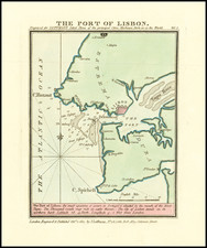
![[Cadiz] Isle Ville et Port De Cadis en Espagne de la Province d'Andalousie a 36.D. de Latitude et 12 Degrez 45 Minutes de Longitude](https://storage.googleapis.com/raremaps/img/small/62354.jpg)
![[ Galicia ] Gallaecia Regnum descripta a F.Fer. Oja Ord Pred.](https://storage.googleapis.com/raremaps/img/small/79693.jpg)