


|
||

|

|
|

|
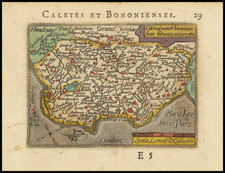
Rare early map of the Champagne region of France, by Jean Le Clerc, and orientated with west at the top. The map is centered on the course of the Marne river and shows Chalons-en-Champagne, Reims, Verdun, Vitry-Le-Francois, and many other cities and towns in the region.
The map originally appeared in Le Clerc's Theatre Geogr du Royaume du France. Following the earlier project of Bougearou to produce a French national atlas, Le Clerc produced this atlas starting in 1616, when he had to flee Paris following an anti-monarchist uprising. The earliest maps were engraved in Tours around this date, including the present, and the book would be published in several editions starting in 1620.
Le Clerc's maps are among the rarest of all French maps; this is the first time we have handled the item.
Jean Le Clerc was an engraver, bookseller and publisher in Paris and Tours.
Le Clerc was baptized on August 16, 1560 in Paris, with the engraver François Desprez (1530–1587) and the painter Jérôme Bollery (1532–1592) as his godfathers. He came from a family of printers and publishers - Jean's younger brother David Le Clerc (1561–1613) and Jean's own son Jean Le Clerc V were both book printers and publishers.
He had proved himself by 1587, at which date he was living and working on Rue Chartière in Paris. For religous reasons, as a Huguenot he fled Paris in 1588 and spent a year elsewhere in France. From 1590 to 1594 he took refuge in Tours, where he worked with the publisher and cartographer Maurice Bouguereau (15??–1596), who created Le Theatre Francoys, the first atlas of France. Le Clerc later worked at several different addresses in Paris - on Rue Saint-Jean-de-Latran until 1610 and then on Rue Saint-Jacques until 1621/24.
Jean Le Clerc's publications included portraits, maps, contemporary news events and other engravings by Jacques Granthomme (1560–1613), Pierre Firens (1580–1636) and Léonard Gaultier (1561–1635). He collaborated with the Dutch printmaker Thomas de Leu (1560–1612) to produce a collection of 179 biblical scenes, allegories, calendar pages and other works, probably published in 1606. They both produced engravings for it themselves as well as using works by Justus Sadeler (1580–1620), Isaac Briot (1585–1670) and Nicolas Briot (1579–1646).
On December 20, 1619 Le Clerc was granted a six-year royal concession to "engrave maps of the provinces of France and portraits of patriarchs and princes of the Hebrew people, with a chronological history". In 1620 he published his Le Théâtre géographique du Royaume de France, including newer plates as well as reworked plates from Bouguereau's work. The new plates were produced by artists such as Jean Fayen (1530–1616), Jodocus Hondius (1563–1612), Salomon Rogiers (1592–1640) and Hugues Picart (1587–1664). It went through several editions and Jean Le Clerc V continued to reissue it after his father's death.
![[Duke of York's Copy] Le Toulois ou sont Les Chatellenies et Les Prevotes du Temporel de l'Eveche de Toul et de son Chapitre; Partie du Balliage de l'Eveche de Verdun. Le Duche de Barrois ou Balliage de Bar le Duc . . .](https://storage.googleapis.com/raremaps/img/small/71292.jpg)
![(First state!) [ Upper Rhine River Valley -- Strasbourg to Basle ] Alsatia et Brisgoia II Rheni Et VII Nova Tabula](https://storage.googleapis.com/raremaps/img/small/94641.jpg)
![[Metz] Le Vray Pourtraict de la Ville de Mets](https://storage.googleapis.com/raremaps/img/small/74161.jpg)
![[ Paris ] La Ville, Cite, Universite, & Faux-Bourgs de Paris](https://storage.googleapis.com/raremaps/img/small/103453.jpg)