
This item has been sold, but you can enter your email address to be notified if another example becomes available.


|
||

|

|
|

|
Stock# 88632
Description
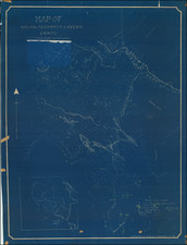
Attractive, detailed map of Mt. Rainier National Park from the 1930s, published by the U.S. Geological Survey and representing an extremely accurate look at the park.
This map shows the park in full, with contour lines, roads, rivers, glaciers, mountains, and much more all indicated. The verso includes a detailed description of the geography and geology of the park for a layman and is complemented by a depiction of the peak as seen from Paradise Park.
This region was mapped by the U.S.G.S in 1910, 1911, and 1913.
Condition Description
Folding map. Printed both sides.

![[Seattle and Vicinity] Seeing Seattle by Water - Anderson Water Tours](https://storage.googleapis.com/raremaps/img/small/77606.jpg)
![Johnson's Washington Oregon and Idaho [Massive Dakota Territory]](https://storage.googleapis.com/raremaps/img/small/98348.jpg)