This item has been sold, but you can enter your email address to be notified if another example becomes available.


|
||

|

|
|

|
Stock# 88467
Description
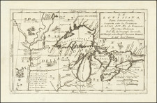
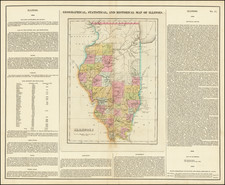
Scarce wall map of Illinois illustrating the post routes of the state during the early-1940s.
The map continues a tradition of post route mapping that began with Nicholson in the 1870s or shortly before that. These post route maps were issued routinely but are rare in any edition today.
This version has air mail routes illustrated with red lines and little symbolic airplanes.
The map includes an inset of Chicago and vicinity.
The key lists the following symbols:
- Post Office
- Post Office Station (Name)
- Post Office, County Seat
- Summer Post Office
- Discontinued Post Office
- Point on Route
- Railroad (showing station)*
- Railway (electric)*
- *Mail lines only are shown
- Mail Messenger
- Special Supply
- Rural Delivery Supply
- Star (contract) Route
- Begging & End of Route
- Six times a week
- Three times a week
- Twice a week
- Once a week
- Air Mail Route
- Motor Vehicle
- Route lines are diagrammatic
Condition Description
Folding map with some toning. Contemporary manuscript annotations in pencil and red pencil. Especially around Chicago.