|
||

|

|
|

|
Stock# 88254
Description
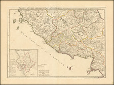
Fine and very decorative antique map showing the course of the Aniene River, using Latin toponyms throughout.
This decorative map shows topography, forests, rivers, towns, and more. The places shown are denoted using their Latin toponyms, for example, the Aniene is referred to as the Anio, and Tivoli is termed Tibur. Roman vias are shown.
The map includes many decorative elements, including a compass rose, characters below the map, and a large pastoral cartouche.
States
This map was republished by Pieter van der Aa in his Galerie Agreeable du Monde. This later state can be identified by the addition of the number 15 just inside of the lower right platemark.
Condition Description
Nice, dark impression. Dampstain entering image at top.
![[ Amalfi Coast / Salerno ] Principato Citra olim Picentia](https://storage.googleapis.com/raremaps/img/small/98621.jpg)
![[ Papal States ] Nouvelle Carte De L'Etat de L'Eglise, Dressee Sur Celle Du P. Boscovich, divisee en trois feuilles . . . 1776](https://storage.googleapis.com/raremaps/img/small/101968.jpg)