|
||

|

|
|

|
Stock# 87649
Description
Nice, large, map of Pretoria, showing the city in fine detail during the end of the Roaring 20s. The map shows individual streets, as well as railways, rivers, and other features.
The map includes an inset of greater Pretoria in the lower left, and a separate inset of the nearby town of Irene.
This detailed map was published by the Pretoria Drawing and Map Office under the supervision of Captain P. C. Paff.
Provenance
This example of the map bears a short note regarding a public transit trip through Pretoria.
Condition Description
Folding. Purple pencil manuscript on verso.

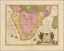
![[Southern Africa] Kaart van het Zuidelykste Gedeelte van Afrika of het Land der Hottentotten](https://storage.googleapis.com/raremaps/img/small/89739.jpg)
![[Southwestern Coast of Africa] Pas-Caart van Guinea en de Custen daer aen gelegen Van Cabo verde tot Cabo de Bona Esperanca](https://storage.googleapis.com/raremaps/img/small/46931.jpg)