|
||

|

|
|

|
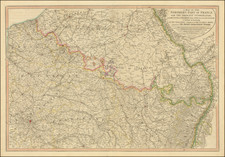
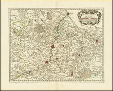
Exceedingly Rare Map of French Encampments during the Nine Years' War, Published Following the Signing of the Treaty of Utrecht.
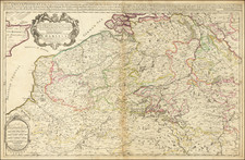
Rare separately published map of Belgium illustrating the theater of war in the Low Countries between 1690 and 1693 and first published after a series of French successes.
This military map chronologically details the movements of the troops from one location to another from May 1690 through October 1693. The map also sketches battle lines onto the map for major engagements. The map is extremely thorough, naming many cities, towns, and other settlements and showing the area's geography in depth.
This map was reissued in a significantly more common Covens and Mortier edition.
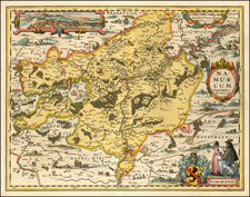
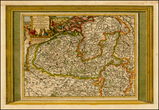
The Belgian Phase of the Nine Years' War
One of the most famous of the Wars of Louis XIV, the Nine Years' War was also known as the War of the Grand Alliance and saw France attempting to expand its borders in all directions. Between 1690 and 1693 (the temporal focus of this map), fighting was focused in the Spanish Netherlands, now known as Belgium.
The period of the heaviest fighting was between 1692 and 1693, as suggested by the increased amounts of French encampments during those periods. At the end of 1693, French gains were significant, however, years of fighting had taken its toll on the French economy. The war was finally ended in 1697. This area was again the focus of fighting during the War of the Spanish Succession, which concluded with the Peace of Utrecht.
States
This is the second known state of the map, with the addition of a text box discussing the Treaty of Utrecht (which dates to 1712) above the scale bar.
Rarity
We trace only a single other example of this map, at the BNF, with a different imprint reading "A Paris. Chez L'Auteur aux Galleries des Louvre. Avec Prvil. du Roy 1694."