This item has been sold, but you can enter your email address to be notified if another example becomes available.


|
||

|

|
|

|
Stock# 87114
Description
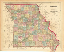
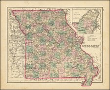
Detailed map of Missouri from Tanner's New Universal Atlas.
Hand-colored by county and showing towns, rivers, lakes, railroads, roads, etc. Table of Steam Boat routes and distances.
The Addition of 1836 appears.
Condition Description
Original hand-color by county. Minor soiling in the margins.
![[Missouri, Illinois, Indian Territory, Kansas, Nebraska, Iowa] Amer. Sep. No. 49. Partie des États Unis](https://storage.googleapis.com/raremaps/img/small/74904.jpg)