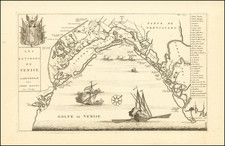


|
||

|

|
|

|
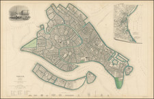
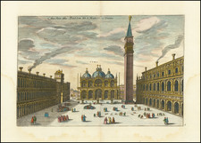
Fabulous double-page SDUK town plan of Venice, with an inset view of the Piazza San Marco from the Grande Canal.
Includes profile views of the Ponte De La Rialto, Piazza Rialto, La Zecca, Prigoni, St. Marco, Palazzio, Piazza San Marco, Chiesa del Redentore, Campanile St. Marco, Chiesa di S. Giorgio Maggiore and Dogana (Customs House). The map is titled with the English, Italian, and German names for Venice; it was at the time a seat (with Milan) of the Lombardo-Venetian Kingdom in the Austrian Empire.
One of the best 19th-century English towns plans to appear in a commercial atlas. The inset map, pictured on an unfurled scroll, shows the Gulf of Venice. A vignette of St. Marks and vicinity is in the upper-left corner. The key shows major buildings at the bottom.
This is perhaps the best of all of the SDUK town plans.
![Le Vere Imagini et Descritioni delle Piu Nobilli Citta del Mondo [The true images and descriptions of the most noble cities in the world]](https://storage.googleapis.com/raremaps/img/small/92842.jpg)
![[ Venice - View of the Rialto District ] A View of the Realto Buildings at Venice | Vue des Edifices, du Realte de Venise](https://storage.googleapis.com/raremaps/img/small/97844.jpg)