


|
||

|

|
|

|
Rare Lewis & Clark era Wall Map of America
Nice example of the first state of Laurie & Whittle's extremely rare wall map of America, published in London in 1809.
Published shortly after the Louisiana Purchase (1804) and the return of Lewis & Clark from the overland expedition to the Pacific (1804-1806), the map illustrates America at a fascinating moment in time. Brazil had become the new home of the Portuguese monarcy (1808) and the first revolutions in South America were fomenting by juntas opposed to colonial rule (1809). Father Hidalgo would declare independence in Mexico the following year (September 1810). Russia would establish New Archangel as the Capital of Russian America in 1808 and begin its expansion into California in 1809, with Fort Ross constructed in 1812. Lewis & Clark's official map would not be released until 1814.
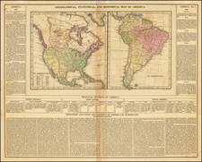
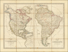
Against this backdrop, much of North America was still largely unmapped and thinly explored. The Transmississippi West was still largely the domain of Fur Traders and Missionaries. While the northern regions were a bit better known and traversed by the Hudsons Bay Company and Northwest Company, even the Old Northwest Territory, which was soon to see the creation of Michigan Territory, Indiana Territory and Illinois Territory was largely unexplored and unsettled, as were vast tracks of land south of the Ohio River in Kentucky, Tennesse and the newly formed Mississippi Territory. Florida was still a Spanish Colonial possession.
The map illustrates a speculative understanding of the discoveries of Lewis & Clark, coming several years after their return, but a full 5 years before the map of the Lewis & Clark expedition was finally released in 1809. Two large notes show the "Course of the Missouri River according to reports of the Indians" and "[t]hese Rives in all probability fall into the R. Missouri are yet unexplored."
The text near Alaska notes:
From the Report of the Expedition, made by order of the Government of the United States, under the command of Captns. Lewis & Clarke, in 1804, 5, 6, it appears that the source of the Missouri, among the Rocky Mountains, is 3120 miles from its mouth, and is navigable, in canoes, to 2 miles from the extend of that distance; also that it is but one mile from the head-spring of this river to the source of one of the tributary Streams of the Columbia. The latter appears to rise as far to the North as 58° or 60° and, being confimed between two ridges of mountains, pursues a south easterly course to latitude 46° whence it proceeds to sea, by a westerly course of about 400 miles. No Map has hitherto appeared which exhibits the course of these Rivers (1809).
It is also noteworthy that Laurie & Whittle illustrate Louisiana Territory as incorporating roughly the northern half of what would become the Republic of Texas, illustrating the poorly understood bounds of the Louisiana Purchase and setting the stage for the disputed boundary that would not be settled until the Adams Onis Treaty in 1819.
In California, a good understanding of the location of the Spanish Missions is illustrated, with a few curious additions.
West of the Missisippi River and on the Lower Missouri River, the map provides considerablly more detail than can be found on Arrowsmith's 1808 map of America.
States of the Map / Rarity
There are apparently two states of the map, 1809 and 1823.
Both states are extremely rare. OCLC locates 2 examples of the 1809 (Multnomah County Library and the Spanish National Library Ministry of Defense Collection.
AMPR notes 1 example, sold by Martayan Lan in 1991. RBH notes 1 auction record (Christies, 2011, noting that the map was not in the British Library).
Robert Laurie (ca. 1755-1836) and James Whittle (1757-1818) formed their Fleet Street, London-based firm upon the 1794 death of their employer Robert Sayer, himself one of the dominant print and mapmakers of the last half of the 18th century.
Laurie & Whittle started managing Sayer's business as early as 1787. They took over all managerial duties when Sayer's health flagged in 1792, and they changed the imprint in 1794 upon his death. Sayer left the two a 21-year lease on the shop (at £100 a year) and on Sayer's Bolt Court premises, as well as an option to acquire stock and equipment at a preferential price of £5,000 payable over three years.
Robert Laurie retired from the firm in 1812, and his role was assumed by his son, Richard Holmes Laurie (1777-1858). The younger Laurie worked with James Whittle until the latter died in 1818. After R. H. Laurie died in 1858, Alexander George Findlay, FRGS (1812-1875) purchased the firm from his daughters. The firm continues today under another name, specializing in yachting charts.
Laurie & Whittle were prolific print and map publishers, and throughout their careers, they produced numerous very important and rare works. They carried on Robert Sayer's atlas business and were responsible for editions of The Complete East-India Pilot and The American Atlas.

![America noviter delineata [ Heightened with Gold Leaf ]](https://storage.googleapis.com/raremaps/img/small/71040.jpg)