|
||

|

|
|

|
Arabie by Alain Manesson Mallet, published in Paris in 1683, is a striking cartographic representation of the Arabian Peninsula, the Red Sea, and the Persian Gulf. This map provides an insightful view of the region, depicting various cities and subregions within the Arabian Peninsula, including Baharem, Mascalat, Mecque (Mecca), and Medina (Medine).
Notable for its decorative elements, the map features two dragons forming an ornate title cartouche, adding an artistic touch to the overall design. This decorative feature enhances the visual appeal of the map and reflects the stylistic preferences of the era.
The Arabie map is part of Alain Manesson Mallet's monumental work, the Description de l'Univers, initially published in Paris in 1683. Regarded as one of the most significant works of its kind in the 17th century, Mallet's Description de l'Univers encompassed a vast range of geographical knowledge and included maps from various regions across the world.
As a historical and cartographic piece, the Arabie map offers valuable insights into the Arabian Peninsula during the 17th century. Its depiction of subregions and geographic features contributes to our understanding of the area's geography and historical context.
In summary, the Arabie map by Alain Manesson Mallet is a visually captivating cartographic work, showcasing the Arabian Peninsula, the Red Sea, and the Persian Gulf. Its inclusion of subregions and decorative elements, along with its association with Mallet's monumental Description de l'Univers, makes it a notable contribution to the world of cartography and a valuab
Alain Mannesson Mallet (1630-1706) was a French mapmaker and engineer who served in the armies of Louis XIV. After rising through the ranks, Mallet was appointed as Inspector of Fortifications, a job which also required mathematical skills and which made him a competent military engineer. Eventually, he joined the court of Louis XIV at Versailles, where he taught math and focused on writing.
Mallet is best known for his Description de L’Univers, first published in 1683, in five volumes. A wide-ranging geographical work, the Description included textual descriptions of the countries of the world, as well as maps of the celestial sky and the ancient and modern worlds. The Description continued to be published until the early eighteenth century. He also published a work in three volumes on warfare (1684) and a primer on geometry (1702).
![Arabia, Petraea et Deserta [Saudi Arabia, etc.]](https://storage.googleapis.com/raremaps/img/small/87833.jpg)
![[Jubail, Saudi Arabia]. Location of Archaelogical Sites - Jubail Area](https://storage.googleapis.com/raremaps/img/small/82295.jpg)
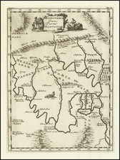
![[ Medina, Saudi Arabia ] Medine](https://storage.googleapis.com/raremaps/img/small/97808.jpg)
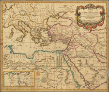
![Turquie d'Asie, Arabie, Perse, Caboul, Beloutchistan et Turkestan [Asia Minor, Arabia, Persia, Kabul, Baluchistan and Turkestan]](https://storage.googleapis.com/raremaps/img/small/94469.jpg)