
This item has been sold, but you can enter your email address to be notified if another example becomes available.


|
||

|

|
|

|
Stock# 8579
Description
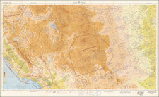
Wonderful map of Texas, colored by counties, and showing the wide open expanses of Western Texas, prior to detailed exploration. A massive Young Territory still is shwon in the Llano Estacado or Staked Plains. Presidio and El Paso Counties are also still very oversized. Several early roads and Wagon Routes are shown, along with railroads, rivers, lakes, forts, Indians andth U.S. Mail Route. An excellent and suprisingly scarce early map. HH Lloyd's Atlas of the United States was never issued as a separate Atlas. Its only appearance is as a supplement to County and State atlases published by Warner & Beers.
![[Republic of Texas] Map of Texas From the most recent authorities . . . 1845](https://storage.googleapis.com/raremaps/img/small/43437.jpg)
![[ West Texas ] Asher & Adams' Texas Western Portion](https://storage.googleapis.com/raremaps/img/small/103870.jpg)
![[Geology Map of the Texas, California & the Southwest] Esquisse Geologique Des Anciennes Possessions Mexicains Du Nord Incorporees Ala Federation des Etats-Unis . . . 1867](https://storage.googleapis.com/raremaps/img/small/71446.jpg)
![[ Texas-Mexico Border Treaty ] Que á efecto de facilitar el cumplimienio [i.e. cumplimiento] del art. 3. del Tratado de limites entre estos Estados y los Unidos del Norte América ... Habiéndose concluido y firmado en la Ciudad de México á los 12 dias del mes de Enero de 1828, un tratado entre los Estados-Unidos Mexicanos y los Estados-Unidos de América [A Treaty having been concluded and signed in the City of Mexico on the 12 day of January 1828 between the United States of America and the Mexican United States for the purpose of establishing the true dividing line and boundary between the two nations]](https://storage.googleapis.com/raremaps/img/small/100806.jpg)
![(Dallas, Texas) USAF Target Complex Mosaic-Series 25 [Sheets 0 - 4]](https://storage.googleapis.com/raremaps/img/small/87119.jpg)