|
||

|

|
|

|
Rare Early Appearances of San Francisco and Hawaii
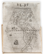
Nice example of Tomas Lopez's scarce map of America and Hispaniola, published in Madrid in 1793.
While intended to illustrate a history of the World and specifically the lands discovered by Columbus, this is a remarkably up to date map, especially for a Spanish publication. Hawaii, while unnamed, is clearly delineated, but perhaps most remarkably, San Francisco is shown, among the earliest printed maps to include the Bay of San Francisco.
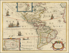
Early Appearances of San Francisco Bay
The discovery of San Francisco Bay by a Spanish Missionary party led by Juan Bautista de Anza was as well guarded secret.
The first appearance of the map is on Miguel Costanso's Carta Reducida Del Oceano Asiatico, Ó Mar Del Sur, Que Comprehende La Costa Oriental Y Occidental De La Peninsula De La California), which was also engraved by Lopez in 1771. The map was followed by a map of America by Lopez dated 1772, but there after, the rest of the cartographic world remained ignorant of the existence of San Francisco Bay until 1790, when a copy of Costanso's map was acquired by Alexander Dalrymple in England, who thereafter published an English copy.
A check of maps we have handled prior to 1793 shows no other maps which locate San Francisco Bay, other than the three mentioned above. Even Lopez's wall map of the World does not include San Francisco Bay.
Tomás López de Vargas Machuca (1730-1802) was one of Spain’s most prominent cartographers in the eighteenth century. He was born in Toledo but studied at the Colegio Imperial in Madrid, where he focused on mathematics, grammar, and rhetoric. Along with a small group of colleagues, in 1752 the Spanish government sent López for training in Paris with the renowned geographer Jean Baptiste Bourguignon d’Anville. When he returned to Spain he was named Geógrafo de los dominios de Su Magestad and put in charge of the geographic collections of Charles III. He published many maps, including his fascinating maps of the Americas, and a variety of geography manuals. Some of his most famous maps are of the Iberian Peninsula, part of his large project to create a majestic atlas of Spain. Unfinished in his lifetime, López's children published the Atlas Geográfico de España (Geographical Atlas of Spain) in 1804. It was republished in 1810 and 1830.
![[Hawaii / Western Pacific]](https://storage.googleapis.com/raremaps/img/small/73805.jpg)
![Cuba Insula [with] Hispaniola Insula [with] Insula Jamaica [with] Ins. S. Ioannis [with] I.S. Margareta Cum Confiniis](https://storage.googleapis.com/raremaps/img/small/95802.jpg)
![[ World & Continents ] Typus Orbis Terrarum / Americae Sive Novi Orbis Nova Descriptio / Asiae Nova Descriptio / Africae Tabula Nova / Europae](https://storage.googleapis.com/raremaps/img/small/99250.jpg)