This item has been sold, but you can enter your email address to be notified if another example becomes available.


|
||

|

|
|

|
Stock# 85339
Description
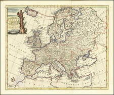
An interesting separate map of Europe from the beginning of the First World War (circa 1914) illustrating the relative powers and geographical coverage of the Triple Alliance and Triple Entente.
On the right are a series of data visualizations showing, for example, the troops of Russia, France, and Great Britain, versus those of Germany and Austria (with Italy having at that time opted to remain neutral). As well as the navy size, aircraft, overseas forces, etc.
The map was issued by the Daily Mail for the London market with cartography from the London Geographical Institute.
Condition Description
Color-printed folding map with original red cloth covers.
![[Eurpean and American Air Routes] TWA Trans World Airline U.S.A. • Europe • Africa • Asia Air Routes](https://storage.googleapis.com/raremaps/img/small/89027.jpg)
![[WWI -- Poster] The Greatest Mother in the World](https://storage.googleapis.com/raremaps/img/small/77109.jpg)

![Carte generale de l'Empire romain [des Sarrasins]](https://storage.googleapis.com/raremaps/img/small/82000.jpg)