|
||

|

|
|

|
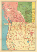
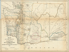
Excellent 1863 lithographed map of a main route across the Rocky Mountains, the military road between the Missouri River and the Columbia.
This War Department map was prepared under the direction of the Topographical Bureau by Captain John Mullan and Edward Freyhold, based on notes taken from 1858 to 1863.
Many winter camps are noted in the Rockies. Coeur D'Alene Lake is illustrated. Some Yakima War battlegrounds are noted. Gold mines and springs are also noted.
Washington State University says of the map and the Mullan Road:
When Washington Territory was created out of the Oregon Territory in 1853, newly appointed Governor Isaac Stevens immediately pushed for the surveying of a route over which a transcontinental railway could be run. To this end, he asked for and got several teams of government surveyors who proceeded to begin charting passes and routes across the Washington Territory. As the best routes were eventually chosen, the survey of the specific route began in 1858. The Mullan road (named for John Mullan, the primary surveyor of the route and the man subsequently placed in charge of the road's construction), a permanent wagon road from the Mississippi River to the Puget Sound, was constructed in 1859-1860. In 1861 and 1862, an improved road was constructed and slightly rerouted. When the Northern Pacific Railroad was built approximately a quarter century later, it followed Mullan's route very closely.
The map was lithographed by Julius Bien in New York.

![[Washington & Oregon] Amer. Sep. No. 38. Partie Des Etats-Unis](https://storage.googleapis.com/raremaps/img/small/93549.jpg)