


|
||

|

|
|

|
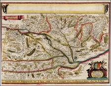
Fine and impressive example of this late-18th-century hydrographical chart of the Austro-Hungarian Empire, showing the inland waterways of this mostly-landlocked nation.
Beautifully engraved in the Viennese style of the period, this large-scale map shows Central Europe extending from Cologne to Belgrade and from Cracow to the Adriatic. The map centers on the Danube and the cities of Vienna and Budapest (here, Buda is transcribed as Ofen, the Germanic name for the city). Possessions of the Austro-Hungarian Empire are shown in color; these include Bohemia, all of Hungary, parts of Italy, and large parts of the Balkans.
The main focus of this map is the river and canal structure of the region, which were the economic and military lifeline of the Empire. In the upper left, seven types of navigable and impassable waterways are represented. The upper right lists nine proposed canals that were either built or under construction, dating back to the time of Charlemagne but mainly from the later 18th century. Active canals are listed at the bottom of the map.
The map includes wonderful imagery of canals, including one narrow boat canal with an impressive lock and tunnel system. Canals were frequently used as decorative elements on maps of this period to demonstrate the marvels of engineering, as on the Arrowsmith map of Europe.
This map was designed by Francois Joseph Maire, a French cartographer who worked at the Viennese firm Artaria and Co.
![[ Holy Roman Empire ] Nova Totius Germaniae Descriptio Geographica](https://storage.googleapis.com/raremaps/img/small/95672.jpg)
![(Hungarian Military Games) Szegvar | A Felek Helyzete és . . . [Szegvar | Positions of the Armies. .]](https://storage.googleapis.com/raremaps/img/small/89265.jpg)
![(Central Europe and Hungary) Ungria Restaurada compendiosa noticia, de dos tiempos: del Passado. Baxo el Jugo de la Tirania Othomana, del Presente, Baxo el Dominio Catholico de Leopoldo II de Austria. [Hungary Restored, Extensive Notices about].](https://storage.googleapis.com/raremaps/img/small/68278.jpg)