This item has been sold, but you can enter your email address to be notified if another example becomes available.


|
||

|

|
|

|
Stock# 84656
Description
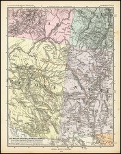
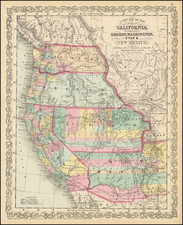
Interesting detailed map of Arizona Territory, hand-colored by county.
Unlike many maps of Arizona from this period, this map focuses only on Arizona and does not also show New Mexico.
The map shows counties, towns, roads, railroads, mountains, rivers, train stations, mines, etc. Only 10 counties are shown.
Condition Description
Original hand-color (applied with stencil) by county.