|
||

|

|
|

|
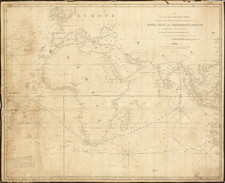
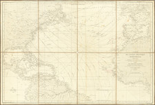
Seafaring chart of the North Atlantic, from one of the most important navigational works on America. This chart would have served as a general guide for hundreds of mid-18th century captains as they sought to go to the pre-Revolutionary American coastline from the Old World.
The map extends from the Irish, Iberian, and African coastlines through the Atlantic Ocean to the West Indies and the eastern coastline of North America. On the East Coast, numerous cities are named although "New York" is overlooked in favor of the Hudson River and Long Island. Boston, Philadelphia, and James Town are all noted.
This map was from an early circa 1759 edition of the English Pilot, Volume IV, published by Mount and Page in London.
The English Pilot
The English Pilot was the navigator's Bible for traders plying the East Coast of North America in the 18th century. While some of its charts seem crude by today's standards, this atlas is highly significant for bringing together, for the first time in an English sea atlas, charts of the entire East Coast of North America - making it an essential tool for traders doing business with the English North American colonies, or in later editions, with the fledgling United States.
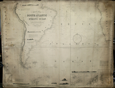
![(South Atlantic) Nieuwe Wassende Graadige Pas-kaart van de Kust van Guinea en Brasilia strekkende van Cap Verde tot de Cap de Bon-Esperance en Verders van Rio de Berbice tot Rio de la Plata. [New Increasing Latitude Sea Chart of the Coast of Guinea and Brazil stretching from Cape Verde to the Cape of Good Hope and Further from the Berbice River to the Rio de la Plata.]](https://storage.googleapis.com/raremaps/img/small/99819.jpg)