
This item has been sold, but you can enter your email address to be notified if another example becomes available.


|
||

|

|
|

|
Stock# 84334
Description
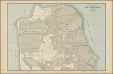
Great vintage geological map of Point Reyes and Drake's Bay, just north of San Francisco and the Bay Area. The map shows the Point and the great San Andres Fault which causes it to jut out into the sea. The map was produced by the USGS based on information compiled by Charles E. Weaver.
The geology of this area is primarily defined by the presence of the San Andres Fault in the region. Southwest of the fault, the rocks are primarily dominated by younger sedimentary formations. Northeast of the fault, the rocks are older and mostly of the complex melanges and intrusive volcanic rocks that dominate the Coast Ranges of California.
Condition Description
Minor toning at edges.
![Alameda County, California. Showing The Automobile Roads and Principal Points of Interest . . . [Livermore Valley Views]](https://storage.googleapis.com/raremaps/img/small/76961.jpg)
![[ San Francisco to Napa & Sonoma ] Chart of the Bay of San Pablo Straits of Carquines and part of the Bay of San Francisco California . . . 1850](https://storage.googleapis.com/raremaps/img/small/100267.jpg)