This item has been sold, but you can enter your email address to be notified if another example becomes available.


|
||

|

|
|

|
Stock# 84179
Description
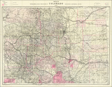
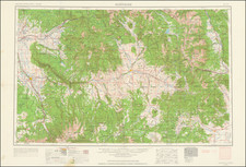
Interesting detailed map of Colorado, published by Tunison in Jacksonville, Illinois.
The map is colored by county, with good topographical detail. Shows counties, towns, roads, railroads, mountains, rivers, train stations, mines, etc.
One of the most interesting atlas maps of the period
![[ Colorado Atlas -- Presentation Copy ] Geological and Geographical Atlas of Colorado and Portions of Adjacent Territory](https://storage.googleapis.com/raremaps/img/small/101702.jpg)