This item has been sold, but you can enter your email address to be notified if another example becomes available.


|
||

|

|
|

|
Stock# 83649
Description
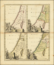
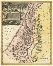
Rare late state of this separately published map of the Holy Land, with cartographic credit given to Jean Baptiste Nolin, one of the great French cartographic publishing firms of the 18th Century.
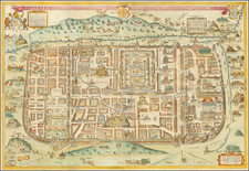
The map includes a detailed treatment of the 12 tribes in the primary map, along with a modern plan of Jerusalem at the time it was under the control of the Ottoman Empire, a plan of Solomon's Temple and a plan of Jerusalem at the time of Christ.
At the height of his success in the late 17th and early 18th Centuries, the senior Nolin was the Geographer to the King of France.
Includes an elaborate cartouche and 2 columns of descriptive text.
Rarity
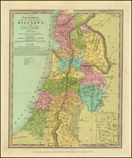
The 1817 edition of the map is very rare. We have not previously seen this map offered for sale.
![[ Maccabee Tomb ] Grafgebouw Der Makkabeen Opgeregt Te Modin](https://storage.googleapis.com/raremaps/img/small/101602.jpg)
![[Beirut, Lebanon] The Port of Beirout in Syria](https://storage.googleapis.com/raremaps/img/small/76131.jpg)