|
||

|

|
|

|
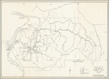
Detailed map of Los Angeles, with a nice birdseye map of the Los Angeles Basin and a second birdseye map of Greater Southern California on the verso. This is one of the more decorative and interesting pocket maps of Los Angeles we have encountered in recent years.
The birdseye view of Los Angeles extends from San Fernando south through San Juan Capistrano, with numerous insets of photos and additional route maps. Below this is a birdseye of the whole southern part of the state, extending from San Francisco to San Diego and the Mexican border. The perspective on these two views is highly artistic and attractive.
Sequoia National Park is shown but greatly reduced in size. The state capital is shown in outline in Sacramento. Branches of the First National Bank of Los Angeles are shown in red, including a branch in Avalon.
![(Early Hollywood Photography) [Studio of R.A. Whitten]](https://storage.googleapis.com/raremaps/img/small/97888.jpg)