|
||

|

|
|

|
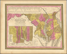
Early Worchester County, Maryland Manuscript Plat Map
An interesting and detailed early plat map for land in Worchester County, Maryland. The plat describes lands from the estate of Israel Cox (1763-1818), a Harford County native who must have died with some outstanding debts. Snow Hill, which is indicated on the map, is located in Worchester County on Maryland's Eastern shore. While Cox was a resident of Harford County, the land shown here was in Worchester County.
The caption title of the map suggests the plat was made to document lands seized from the estate of the late Israel Cox, perhaps as part of a probate case. Harford County court records from 1833 include a case concerning some of Cox's creditors claiming fraud on certain deeds granted by Cox to his children shortly before his death.
Dated and signed in lower left corner: February 13th, 1834 / James Steel. James Steel was a surveyor active in Harford County, Maryland during the first decades of the 19th century. Drawn at a scale 30 perches to an inch, the plat is very neatly drawn, with outline color and a very nice colored fleur-de-lis north mark.
Names of land owners and placenames on the plat:
- Israel Cox
- Sedgwick James [listed in 1810 census as living in Havre de Grace]
- William Stansbury
- Hutchinson's Discovery
- McCoy's part of Prospect
Text on the plat describes the land in some detail:
- A. The beginning of Snowhill numbered with blue figures and exhibited by blue lines from the end of the second line. Also the beginning of Geoff[r]ey's Romantic. Prospect in red lines and red figures.
- A. Is also the beginning of Prospect a Resurvey of Geoffrey's Romantic Prospect in black lines and black figures
- B. [black ink] The beginning of Guion's [?] Meadow-land in blue lines and blue figures is 18 then to 24 and then to B.
- B. [blue ink] The beginning of 70 acres of Hutchinson's Discovery conveyed by Sedgewick James to Israel Cox.
- C. [blue ink] The beginning of Israel Finishing Stroke Cox's Security lies between Snowhill and Prospect from the second line to the sixth. The Strip is between the 9th lines of said tracts.
William Stansbury's purchase begins at this blue letter and is shaded with red. The remainder of Cox's land lies within the yellow shade.
Other features identified on the map:
Snowhill, Part of Hutchinson's Discovery, Beginning of grove, an unnamed mill, Israel's Finishing Stroke, stone heap, black rock, Road to Peach bottom, an unidentified house, and a partially drawn network of rivers.
On the verso, the name E. Coale appears. This is likely Eliza Coale, who, for example, purchased Hutchinson's Discovery in 1832, after the conveyance from Israel Cox to Sedgewick James was declared void:
Conveyed to Sarah Stansbury during her natural life, and at her death to her son, Isaac, by Israel Cox January 29, 1817. Conveyed to said Israel Cox by Sedgwick James. - Above conveyance declared void. - Sold to Mrs. Eliza Coale 1832 - Maryland State Archive.
Overall an attractive early 19th-century manuscript plat map for Worchester County, Maryland, whose county seat remains the town of Snow Hill.
James Steel was a surveyor, active in the early decades of the 19th century at Harford County, Maryland.
He was actively involvedin the survey of the Baltimore and Harford Turnpike roads.