


|
||

|

|
|

|
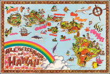
Large Map of the Territory of Hawaii
Detailed large format map of the Hawaiian Islands, published by the General Land Office.
Finely detailed map, showing counties, towns, bays, points, mountains, rivers, elevations, volcanoes, volcano houses, halfway houses and lava flows from various eruptions (some dated), and other details. Includes a table of distances in nautical miles to various major ports of the Pacific Ocean.
The mapping of territorial Hawaii in the early 20th century was an important and fascinating chapter in the history of cartography. During this time, Hawaii was a newly established territory of the United States, and the process of mapping the islands was an essential part of establishing the territory's boundaries and infrastructure. In 1900, the United States Congress passed the Hawaii Organic Act, which officially established the Territory of Hawaii. This act gave the territory a new governmental structure and provided for the appointment of a governor, a legislature, and other officials. The act also gave the United States the power to annex additional territories in the future.
As part of the process of establishing the new territory, a number of maps of Hawaii were created during this time. These maps were used to define the boundaries of the territory and to identify the location of major cities, towns, and other landmarks. The maps were also used to plan the construction of new roads, railways, and other infrastructure projects.
![[ Hawaii ] Iles Sandwich Oceanique No. 3.](https://storage.googleapis.com/raremaps/img/small/103276.jpg)
![[Kilauea Volcano] The Crater on the Summit of Mount Worroray, Owhyhee](https://storage.googleapis.com/raremaps/img/small/91698.jpg)
![[Early Hand Drawn Map of the Hawaiian Islands]](https://storage.googleapis.com/raremaps/img/small/62429.jpg)
![Map of Mexico, Central America, and the West Indies [Insets of Bermuda, Sandwich Islands, Jamaica and Panama Railroad]](https://storage.googleapis.com/raremaps/img/small/78369.jpg)