|
||

|

|
|

|
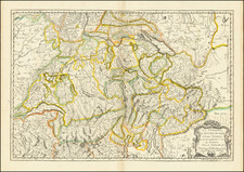
Mammoth eight-sheet lithographed wall map of Switzerland issued by Heinrich Keller in Zurich in circa 1870.
The map shows the topography of the mountainous nation in all its glory with meticulous hachuring building up the many peaks and valleys of the Alps.
Hand-coloring differentiates the cantons of Switzerland per the key in the upper-right corner.
True to its Swiss heritage, the map is German-French-Italian trilingual.
The map was lithographed by R. Leuzinger in Bern.
The date is estimated based on the range seen in several entries in OCLC.
Certainly one of the best wall maps of Switzerland from the 19th century.
Heinrich Keller (1778-1862) was mapmaker and lithographer from Zurich.
Heinrich Keller came from a humble background living in family from Zurich, his father was a baker. At the age of eight, he suffered a severe broken leg which had him bed ridden for several years, where he began to draw.
After 1797, he was an apprentice to the painter and art dealer Henry Fuseli (1755-1829) in Zurich and worked there until 1815. In 1799, he had drawn a map for a guidebook, later followed by similar works. In 1827, he published a map of the Canton of Zurich and in 1830, he produced a wall map of Switzerland. Keller was promoted among others by Hans Conrad Escher von der Linth.
Keller's panoramic views would ultimately bring him great recognition. In 1817 he separated from Füssli and led from then on his own publishing house.
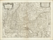
![Nova Rhaetiae atq[ue] totius Helvetiae descriptio per Aegidium Tschudum Glaronensem](https://storage.googleapis.com/raremaps/img/small/80319.jpg)
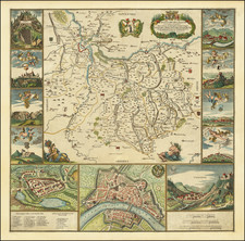
![[Rhine River] Nova Totius Rheni Descriptio ex celeberrimis et varijs Autoribus, in unam tabulam redacta . . . 1672](https://storage.googleapis.com/raremaps/img/small/62395.jpg)