|
||

|

|
|

|
Stock# 82027
Description
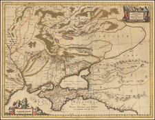
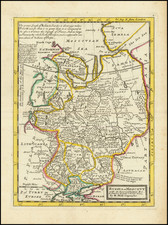
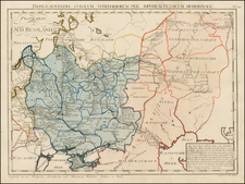
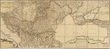
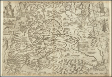
Original antique map, published in 1679 in Paris by Nicolas Sanson the Younger, showing the European portion of Russia. The map extends southwards to the Sea of Azimov, westwards to Poland and the edge of the Baltic States, northwards to the Arctic Sea, and eastwards to the Ural Mountains.
The map shows the antiquated layout of the region, as it was in Roman times. Roman outposts and cities are shown, and the territorial divisions of various tribes and state entities are shown. Rivers, mountains, forests, and other hydrographical features are shown.
Condition Description
Original hand-color in outline. Contemporary extended margins. Minor wormholes.