|
||

|

|
|

|
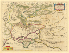
An uncommon and interesting map focusing on the German colonization of the Volga region. The map shows the amounts of Germans and other populaces living in various population centers along this stretch of the Volga, centered on Saratov and extending as far south as Krasnoarmeysk.
This map was based on information compiled by Andreas Mergenthaler from USSR census data taken in 1926 and published in 1939. This publication date reflects a period in which the German state was very much interested in ethnic Germans who lived outside the country's borders. However, the majority of publications looked at regions closer to the German homeland. Thus, it is interesting that, two years prior to Operation Barbarossa, publications were discussing the Germans who lived within the USSR's borders.
The area was populated by Germans during the reign of Catherine the Great, by Central Europeans, in particular ethnic Germans, who were enticed by the agricultural prospects of the region.
1939 or 1971?
The dating of this map is problematic, despite the date that appears on the map of 1939. Several maps published under this title appeared in the 1960s, with a more prolific run appearing in 1971. No images of this map appear to exist online, and cataloging by libraries is sporadic. One example resides in a Polish institute that they have dated to 1939, however, no cataloging accompanies it.
In 1971, a very limited publication appeared by the "American Historical Society of Germans From Russia," in which a photolithograph of this map appeared. The cataloging from LOC, which has an example of the 1971 map, describes it as identical to our map, except that the "1939" and "8/9" are illegible in the lower right-hand margin. It is uncertain if this is the case because their map is a later edition, or simply if theirs is from a poor printing.
The abundance of the later 1971 map suggests that this example is more likely to be from that printing. However, it is entirely possible that, due to the discrepancy between the legibility of the copyright line in our example and in the LOC example, ours comes from an earlier printing. This may mean that the map comes from the 1960s, or possibly even the 1939 first printing.
![Moscovia Parte Orientale . . . [with] Parte Occidentale . . .](https://storage.googleapis.com/raremaps/img/small/26615.jpg)
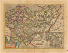
![[ Russia, Poland, Ukraine, Belarus ] Kriegsstrassen Karte Eines Theiles Von Russland und der Angraenzenden Laender. Nach der unter der Leitung des Russ. kaiserlichen Generalstabes vom General Major Schubert im Masstabe von 1/1680000 im Jahre 1829 hrsg. Karte - auf das Mass von 1/1400000 vergrössert, von dem k.k. ofterr Generalquartierm eisterstabe Herausgegen im Jahre 1837.](https://storage.googleapis.com/raremaps/img/small/100484.jpg)
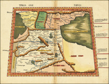
![[Ukraine, Russia] Asiae II Tab:](https://storage.googleapis.com/raremaps/img/small/89178.jpg)