![Vienna [Wien] By SDUK](https://storage.googleapis.com/raremaps/img/small/93386.jpg)


|
||

|

|
|

|
A fabulous town plan of Vienna, with profiles of 12 famous structures at the bottom of the map. In the map, we see the city's layout before the rebuilding of the city in the late 19th century and the development of the Ringstrasse. As with most SDUK city maps, detail is extensive in this example.
In the map, the city retains its early layout with two sets of ramparts, one around the outer perimeter of the city and one just around the Innere Stadt. The two cities would not be joined politically or spatially until the mid-19th century when the ramparts were dismantled and replaced by the Ringstrasse. This ring road, attractive in its own right, is commonly used as a prime example of "historicism," or how time defines the use of space. The early ramparts made for a crowded and separated city which lead to its medieval characteristics, while the Ringstrasse allowed for a more connected and inclusive use of space.
Around the city we see the many public parks that can still be found. The Prater extends from the Donaukanal to the Danube proper providing an open space where Viennese residents could relax. The buildings shown at the bottom provide a view on some of the older monuments of Vienna, not all of which are still around. While some of these are still popular destinations, especially in the Innere Stadt, most of the now-famous buildings of Vienna were soon to be built in revolutionary styles, some of which would develop in Vienna itself.
This is one of the best 19th-century English-language town plans to appear in a commercial atlas.
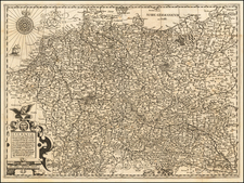
![[ Holy Roman Empire ] Nova Totius Germaniae Descriptio Geographica](https://storage.googleapis.com/raremaps/img/small/95672.jpg)
![(Italy and Austria) Carta geografica statistica postale dell’I.R. Monarchia Austriaca e dell’Italia [Statistical postal geographic map of the Imperial Royal Austrian Monarchy and of Italy]](https://storage.googleapis.com/raremaps/img/small/94038.jpg)
![Der Strudl an der Donau [on sheet with:] Der Wurbel in der Donau](https://storage.googleapis.com/raremaps/img/small/94420.jpg)