|
||

|

|
|

|
Highly detailed town plan of St. Petersburg, showing streets, buildings, rivers, parks, public squares, churches, bridges, and a host of other details. Large vignette of the Winter Palace, Admiralty, War Office, Statue of Peter I, Isaac's Church and the Isakiefskoi Bridge in the foreground.
A detailed map of Imperial Russia's premier center of culture and power. Incredibly useful for understanding the contemporary layout of this deltaic city that was built on the graves of 10,000 conscripts. 1830s St. Petersburg was at the height of the Empire's, and thus the city's, prominence. With the typical Russian lag, romanticist styles had not yet become popular in St. Petersburg. Thus, this map preserves a view of the city before both its Romantic rebuilding and Soviet-era expansion.
This map provides a unique and fascinating picture of 1830s St. Petersburg. It can act as a good companion to many works of classic Russian literature. On the map, one can trace the scandals of Vronsky and Karenina through the fashionable part of the city, or follow Raskolnikov and see how the back streets of the city may have looked around the time.
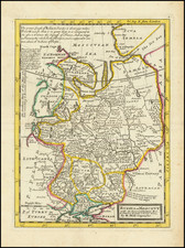
![[ Earliest Obtainable Map of Russia, Ukraine, and the Caucauses ] Secunda Asiae Tabula](https://storage.googleapis.com/raremaps/img/small/82673.jpg)