|
||

|

|
|

|
Stock# 81395
Description
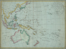
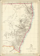
Large detailed map of Australia, showing bays, capes, creeks, islands, lakes, mountains, ports, rivers, shoals, towns, etc.
The Colony of South Australia is separately shown. Populations for New South Wales, Van Dieman's Land, Port Phillip, South Australia, West Australia and North Australia are shown. Stuart's farthest north on Eyre's Creek is shown. The interior is quite unknown.
An excellent early map of Australia.
Condition Description
Minor foxing. Cut to platemark.
![Carte Generale de L'Oceanie . . . . 1866 [Pacific Ocean]](https://storage.googleapis.com/raremaps/img/small/99167.jpg)