|
||

|

|
|

|
Stock# 81393
Description
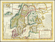
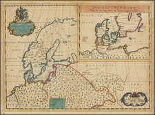
Detailed map of Denmark, extending to Holstein and Oldenburg, with a large inset map of Bornholm island, off the Swedish coast. The map was engraved by Robert Wilkinson in London in 1808.
Robert Wilkinson was active in London as a cartographic publisher from 1785 to 1825. He produced a number of nice works, including a General Atlas and a re-issuance of Bowen & Kitchen's English Atlas, along with excellent large format separate maps.
Condition Description
Original hand-color. Narrow margins. Very minor soiling.